
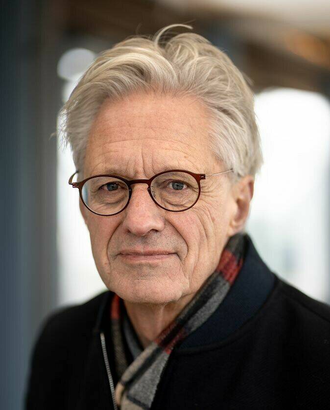
By: Anka van Voorthuijsen
Photo credit: Kick Smeets
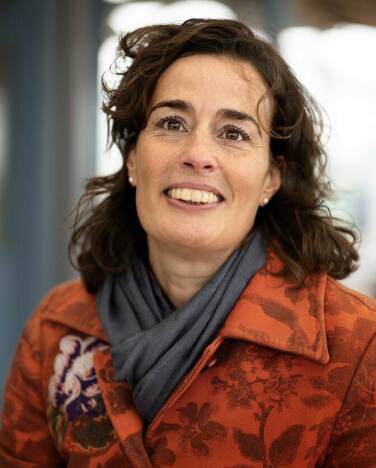
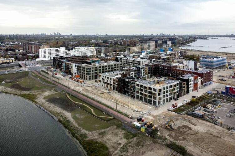
Twenty-five years ago, urban planner Frits Palmboom jotted down the initial sketches for the IJburg artificial islands in Amsterdam. As the Team Lead for the Eastern Flank, spatial planner Tine Sommeijer is currently working on the final stage of the IJburg project. There’s one thing the two experts absolutely agree on: “It’s wrong to develop the city at the expense of its bodies of water. Instead, you need to make an effort to understand the water and keep in mind that it’s the city that is the guest here.”
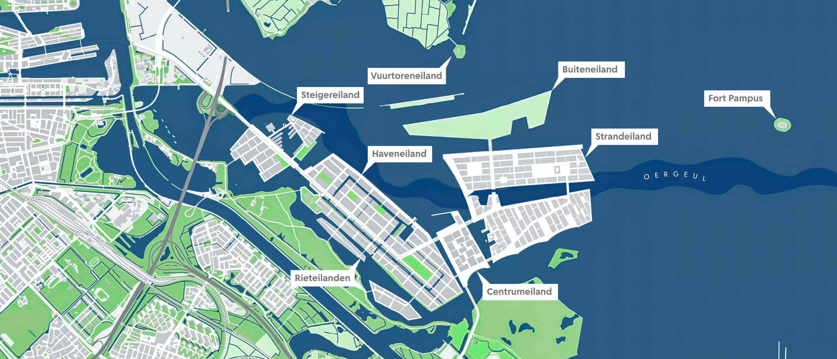
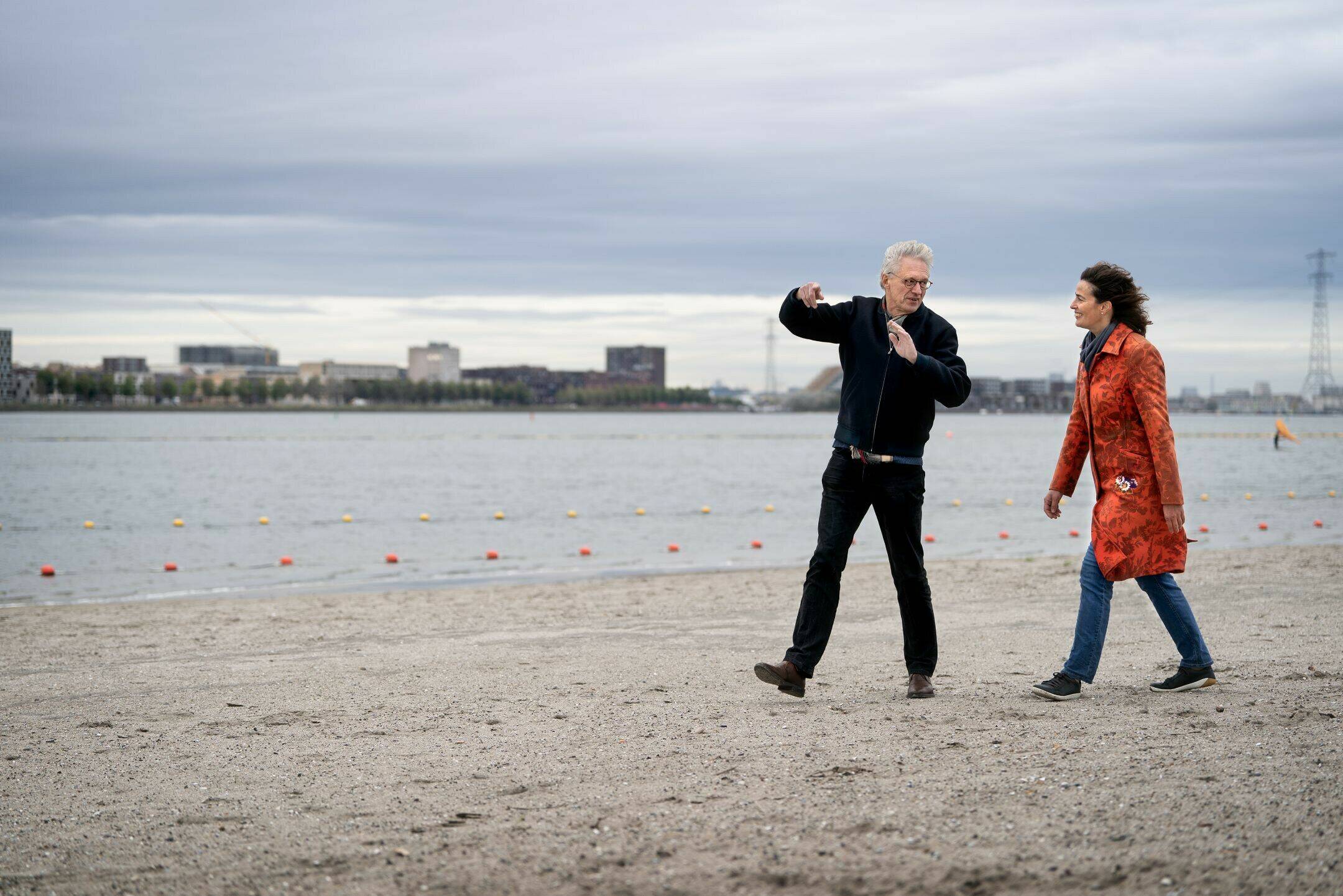
At the photographer’s request, Sommeijer and Palmboom climb on top of a container to pose for their picture. As you might expect given the location, the weather is exceptionally blustery today, and the view consists mainly of a massive, sloshing lake and an impressive patch of sand, known as Strandeiland (Beach Island). “Wow!”, Tine exclaims, and that’s when it suddenly dawns on Frits: “We’re essentially on the second floor of a private residence. The sheer amount of space here just blows me away!” Tine points towards Vuurtoreneiland, the future site of Buiteneiland. “That area will remain green and empty.” “What a genius move!”, they call out to each other, as they face the strong headwind.
The original plan for Buiteneiland included 2,000 new low-rise housing units, overlooking a scenic view of trees from Vuurtoreneiland. According to the latest plans, there will be virtually no homes on Buiteneiland, as opposed to Strandeiland, which will contain a larger amount of new housing. “Buiteneiland is a green space, to be used for recreational purposes and for anyone who enjoys natural beauty. It will become a haven of tranquility in an increasingly crowded city.”
Open framework
Over coffee at the Strandlokaal venue later on, the two urban-planning professionals regularly drop the word ‘framework’. “It’s important to leave a little leeway, rather than laying everything down in a contract at an early stage,” they both agree.
The Strandlokaal space houses the IJburg information centre, which is intended for local residents, as well as serving as a base for the IJburg quality assurance team. Helms, hi-vis vests and boots in all sizes are all stored away in a cabinet: “that’s for when our team heads out to the beach.” While Frits serves as chairman, the Eastern Flank Team is responsible for designing the last few islands. Tine stresses what a valuable partner Frits has been to her: “Frits is a wonderful resource on all things related to IJburg; he’s aware of the ideas that were floating around in those early days. Whenever we explain our decisions to him, we instantly know whether we’re on the right track.”
The Strandlokaal venue contains a mock-up of stage 2 of the project, comprising the Centrumeiland, Strandeiland and Buitenland areas. Tine then points to some square shapes, small trees, bridges, open spots, and marinas with boats. “These are the outlines of the islands – the banks, the spot where you’ll find the bodies of water and parks, public transport, the main road network. That has all been established. But since it’s a framework, there’s still room for further iteration.”
A different view
Both Sommeijer and Palmboom feel this is essential: “Take the growing popularity of electric bikes, for example – this has already changed the way we look at the details of the urban plan compared to a few years ago. There’s also the rapid increase in the number of solar panels: while sustainability is obviously the number-one priority, we can’t say how it will eventually shake out. You still see a lot of large building blocks around Haveneiland. Centrumeiland is a lot more sparse, with many different private and public clients. The space is definitely there, and it can be covered by the framework.”
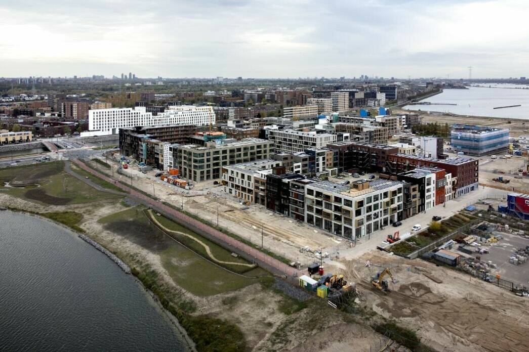
One thing that has been cemented: the future residents of the 8,000 homes on Strandeiland will be able to get around their island jogging, on foot, or by bike. A continuous path will be constructed along all the banks of the waterway. “This was created based on the need for a robust and healthy city, where people have the space to move around.”


Shady spot at the Strandlokaal centre at Strand IJburg
(IJburg Beach)

Strandlokaal IJburg centre, located next to the De Japanner restaurant. Het Strandlokaal serves both as an information centre and as space for community involvement and initiatives.
Bottom-up process
Frits: “Creating new land is a bottom-up process – that’s how the city was constructed too, way back when. You look at what’s available in terms of water, land, and types of soil, and you then go and use that in your designs. Quays, bridges, sea locks, and streets... That tradition fell somewhat by the wayside back in the 1950s, 1960s and 1970s. Back then, we would simply pile on a layer of sand and then built a new city there we had just sketched out. Things have shifted somewhat since then, and these days you simply accept what’s available and then start playing around with that... How do you integrate everything into the existing city, and the IJmeer? It’s challenges like that which make a city more interesting.”
On Strandeiland, the designers had to contend with the original channel, which turned out to be 30 metres deeper than the surrounding water. Tine: “That means you can’t drive any piles there, as you need much longer piles for that purpose.” So what happens next? The original channel becomes Het Oog (The Eye), a recreational pond on the Strandeiland.”
‘Frogs and teenagers’
As Tine explains, the challenge in creating land is becoming more ambitious all the time: “As a designer, you need to factor in a growing number of uses, which means you have to consider the needs and interests of both frogs and teenagers who want to play sports. Of course, a winning city is sustainable in all areas. It needs to be climate-adaptive, respectful of the natural surroundings, accessible, provide a healthy living environment, must be built from materials you won’t regret using down the line, and so on and so forth. The challenges have become more substantial and more complex over the years.”
That’s what makes cooperation so essential. It all started 25 years ago, with the establishment of the IJburg Project Bureau. Frits: “Stadsontwikkeling generally worked out a plan, after which the other disciplines got to share their input. But this time around, we all found ourselves at the Weesperstraat offices together. These were employees from different departments: urban planners, along with civil engineers, environmentalists, and traffic experts. It’s all based on equality, and they all have a substantial amount of influence.”
The Project Bureau kicked off with a three-day information-sharing conference: “The whole experience was wonderfully inspiring, which generated a lot of exciting new knowledge.”
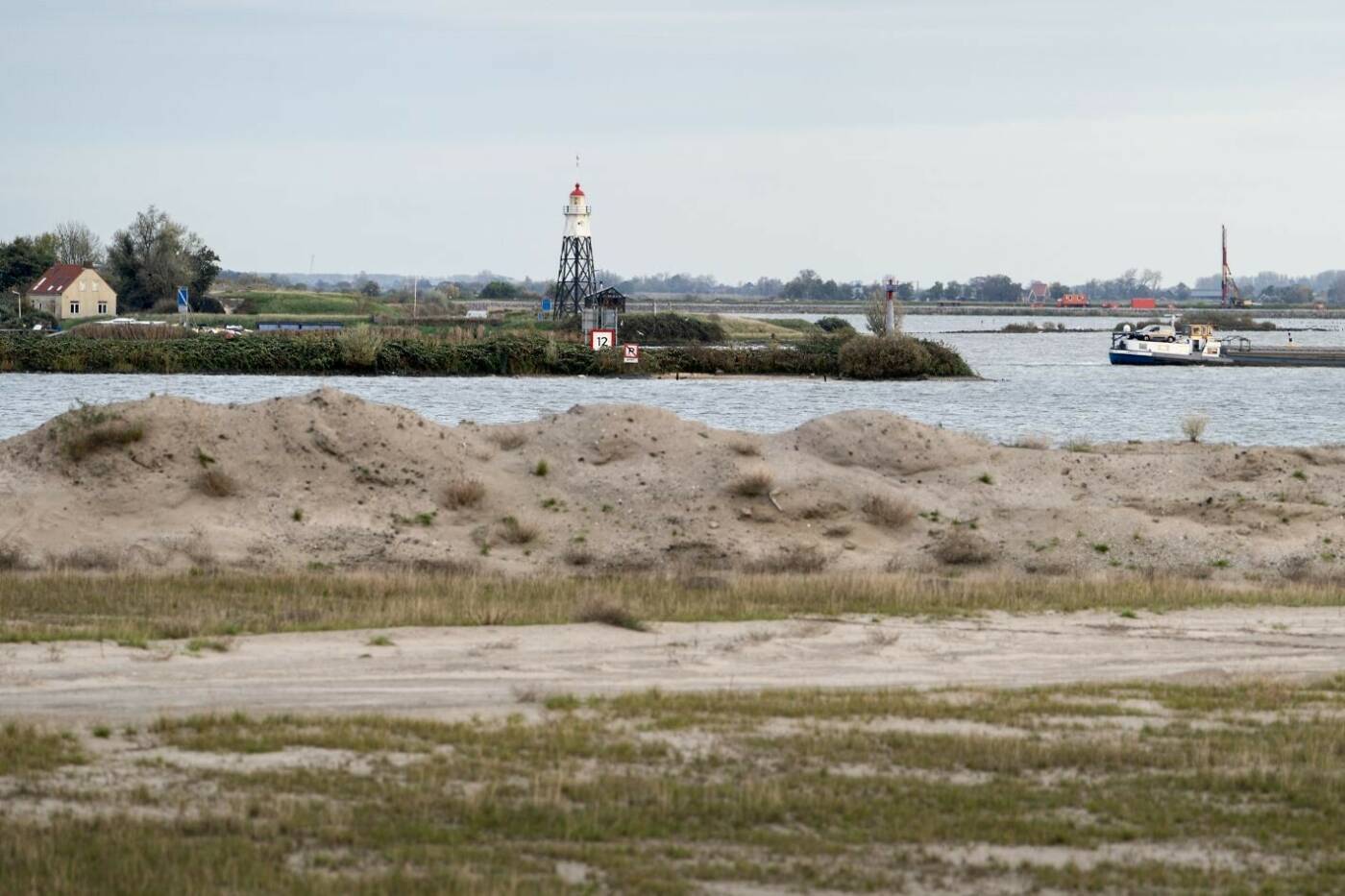
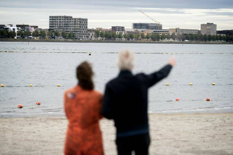
View over Vuurtoreneiland
Leeward and windward
The team’s primary mission was, of course, to build a large number of new homes. Once the ring dike is constructed, a section of the IJmeer will be reclaimed, the water will be drained, and you can start building. “The IJmeer bordering lake was a nature reserve at the time, and our project bureau didn’t want to develop the city at the expense of the water. We wanted to improve our understanding of the world of water.” So the solution wasn’t land reclamation, but rather creating all-new islands.
Tine: “You’re bringing together the two different worlds of homebuilding and nature, and I’m proud to say we have just about succeeded. Water is IJburg’s greatest asset, and the water has never been as clean as it is now.”
As they explain, they are perfecting the art of island design. Frits: “In many different areas, we are seeing transitions between land and water. Every island has a leeward side and a windward side. The windward side bears the brunt of the waves, so you know you need to build solid wharfs. On the leeward side, we are seeing gently sloping shorelines. You’ll find other bird species there, as well as different types of fish and vegetation. The result is greater biodiversity, but within the same island.”

Maximum enjoyment
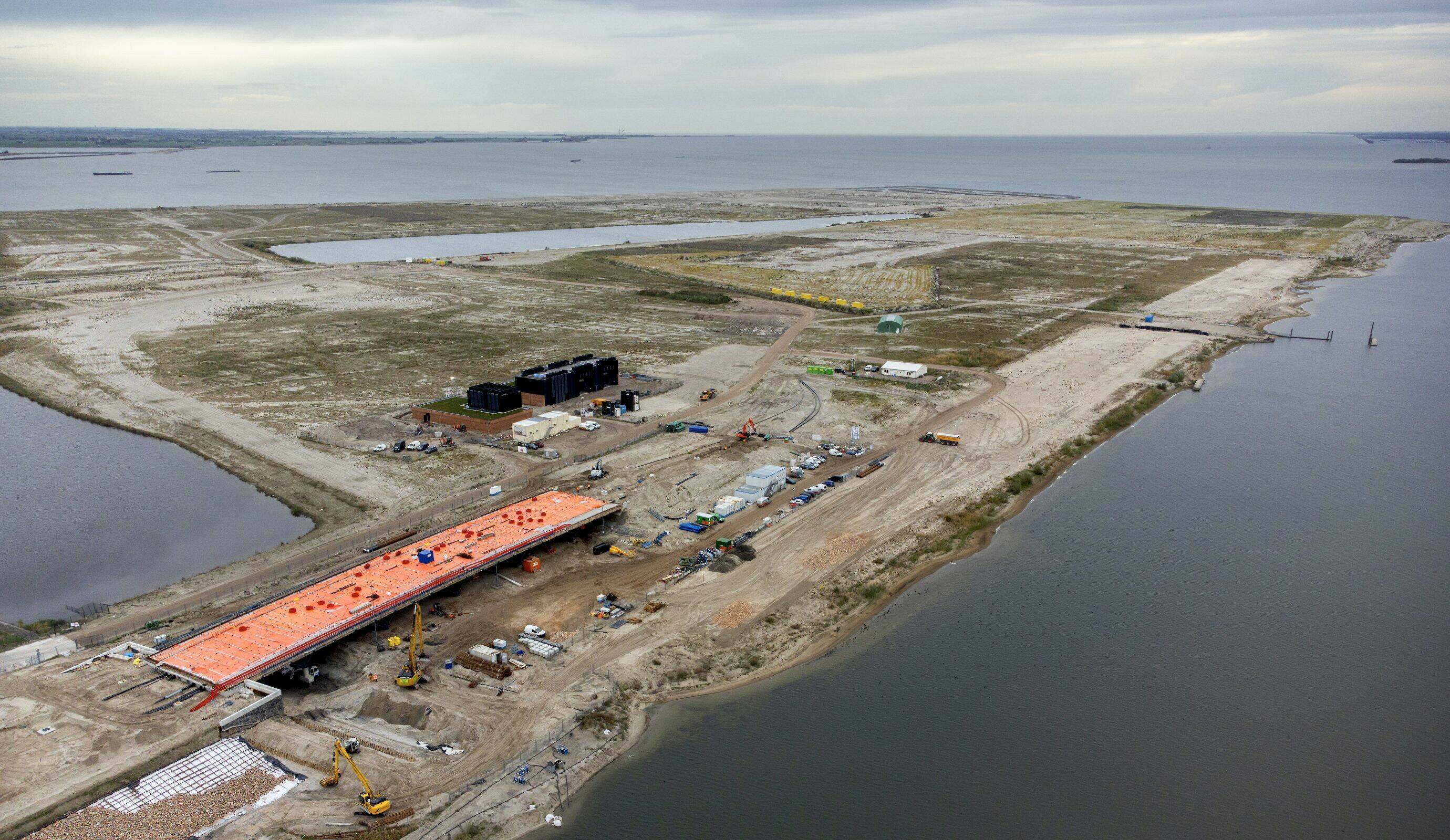
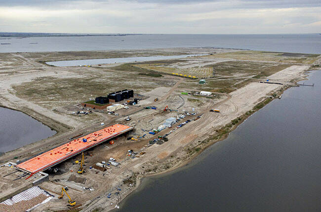
Centrumeiland is nearing its completion, and the first residents will be moving to Strandeiland four years from now. It’s not clear at this point when Buiteneiland will be completed. The island is built from sand that is released during projects in the existing city: an example of sustainable area development. “The date of completion will depend on the amount of sand produced in the rest of Amsterdam.
Tine clearly enjoys the sight of the sand and water as she watches the dogs frolicking around on the beach. “I love wild swimming – it’s the best feeling in the world! The beach is great in the summer, but it’s certainly put to good use right now as well.”
So, will any new islands be added to IJburg? “Not if we have any say in it,” Sommeijer and Palmboom answer in unison. “IJmeer has all that tremendous space, which future residents will be able to enjoy. But you can’t just keep creating new islands ad infinitum. Pampus is still this magical island in the centre of all that open water, and I think you should keep it that way. As the city continues to grow in population, that open space will only become more precious.”
Want to know more?
Hoe IJburg begon (The Origins of IJburg)
Strandeiland: nieuwe stadswijk aan het IJmeer (Strandeiland: new urban district on the IJmeer)
Strandlokaal en informatiecentrum IJburg (Strandlokaal venue and IJburg information centre)
The plans for the stage 2 islands are in line with the Amsterdam Environmental Plan 2050. Creating a city together – in an alliance of civil servants, residents, and other stakeholders – is a key part of that process. It all happens at the Strandlokaal venue and online at Hallo Strandeiland.

Strandeiland:
Playing around with sand and water
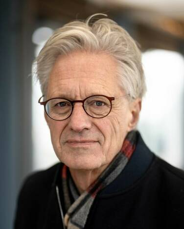
Tine Sommeijer and Frits Palmboom
Contents
Nederlands

By: Anka van Voorthuijsen
Photo credit: Kick Smeets
Twenty-five years ago, urban planner Frits Palmboom jotted down the initial sketches for the IJburg artificial islands in Amsterdam. As the Team Lead for the Eastern Flank, spatial planner Tine Sommeijer is currently working on the final stage of the IJburg project. There’s one thing the two experts absolutely agree on: “It’s wrong to develop the city at the expense of its bodies of water. Instead, you need to make an effort to understand the water and keep in mind that it’s the city that is the guest here.”
At the photographer’s request, Sommeijer and Palmboom climb on top of a container to pose for their picture. As you might expect given the location, the weather is exceptionally blustery today, and the view consists mainly of a massive, sloshing lake and an impressive patch of sand, known as Strandeiland (Beach Island). “Wow!”, Tine exclaims, and that’s when it suddenly dawns on Frits: “We’re essentially on the second floor of a private residence. The sheer amount of space here just blows me away!” Tine points towards Vuurtoreneiland, the future site of Buiteneiland. “That area will remain green and empty.” “What a genius move!”, they call out to each other, as they face the strong headwind.
The original plan for Buiteneiland included 2,000 new low-rise housing units, overlooking a scenic view of trees from Vuurtoreneiland. According to the latest plans, there will be virtually no homes on Buiteneiland, as opposed to Strandeiland, which will contain a larger amount of new housing. “Buiteneiland is a green space, to be used for recreational purposes and for anyone who enjoys natural beauty. It will become a haven of tranquility in an increasingly crowded city.”
Open framework
Over coffee at the Strandlokaal venue later on, the two urban-planning professionals regularly drop the word ‘framework’. “It’s important to leave a little leeway, rather than laying everything down in a contract at an early stage,” they both agree.
The Strandlokaal space houses the IJburg information centre, which is intended for local residents, as well as serving as a base for the IJburg quality assurance team. Helms, hi-vis vests and boots in all sizes are all stored away in a cabinet: “that’s for when our team heads out to the beach.” While Frits serves as chairman, the Eastern Flank Team is responsible for designing the last few islands. Tine stresses what a valuable partner Frits has been to her: “Frits is a wonderful resource on all things related to IJburg; he’s aware of the ideas that were floating around in those early days. Whenever we explain our decisions to him, we instantly know whether we’re on the right track.”
The Strandlokaal venue contains a mock-up of stage 2 of the project, comprising the Centrumeiland, Strandeiland and Buitenland areas. Tine then points to some square shapes, small trees, bridges, open spots, and marinas with boats. “These are the outlines of the islands – the banks, the spot where you’ll find the bodies of water and parks, public transport, the main road network. That has all been established. But since it’s a framework, there’s still room for further iteration.”
A different view
Both Sommeijer and Palmboom feel this is essential: “Take the growing popularity of electric bikes, for example – this has already changed the way we look at the details of the urban plan compared to a few years ago. There’s also the rapid increase in the number of solar panels: while sustainability is obviously the number-one priority, we can’t say how it will eventually shake out. You still see a lot of large building blocks around Haveneiland. Centrumeiland is a lot more sparse, with many different private and public clients. The space is definitely there, and it can be covered by the framework.”
One thing that has been cemented: the future residents of the 8,000 homes on Strandeiland will be able to get around their island jogging, on foot, or by bike. A continuous path will be constructed along all the banks of the waterway. “This was created based on the need for a robust and healthy city, where people have the space to move around.”
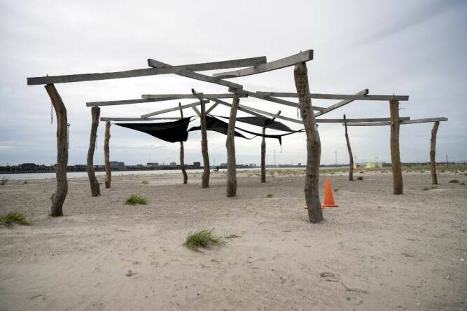
Shady spot at the Strandlokaal centre at Strand IJburg (IJburg Beach)

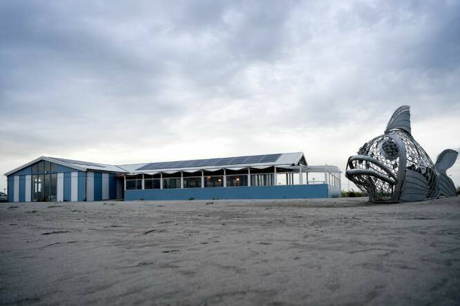
Strandlokaal IJburg centre, located next to the De Japanner restaurant. Het Strandlokaal serves both as an information centre and as space for community involvement and initiatives.
Bottom-up process
Frits: “Creating new land is a bottom-up process – that’s how the city was constructed too, way back when. You look at what’s available in terms of water, land, and types of soil, and you then go and use that in your designs. Quays, bridges, sea locks, and streets... That tradition fell somewhat by the wayside back in the 1950s, 1960s and 1970s. Back then, we would simply pile on a layer of sand and then built a new city there we had just sketched out. Things have shifted somewhat since then, and these days you simply accept what’s available and then start playing around with that... How do you integrate everything into the existing city, and the IJmeer? It’s challenges like that which make a city more interesting.”
On Strandeiland, the designers had to contend with the original channel, which turned out to be 30 metres deeper than the surrounding water. Tine: “That means you can’t drive any piles there, as you need much longer piles for that purpose.” So what happens next? The original channel becomes Het Oog (The Eye), a recreational pond on the Strandeiland.”


‘Frogs and teenagers’
As Tine explains, the challenge in creating land is becoming more ambitious all the time: “As a designer, you need to factor in a growing number of uses, which means you have to consider the needs and interests of both frogs and teenagers who want to play sports. Of course, a winning city is sustainable in all areas. It needs to be climate-adaptive, respectful of the natural surroundings, accessible, provide a healthy living environment, must be built from materials you won’t regret using down the line, and so on and so forth. The challenges have become more substantial and more complex over the years.”
That’s what makes cooperation so essential. It all started 25 years ago, with the establishment of the IJburg Project Bureau. Frits: “Stadsontwikkeling generally worked out a plan, after which the other disciplines got to share their input. But this time around, we all found ourselves at the Weesperstraat offices together. These were employees from different departments: urban planners, along with civil engineers, environmentalists, and traffic experts. It’s all based on equality, and they all have a substantial amount of influence.”
The Project Bureau kicked off with a three-day information-sharing conference: “The whole experience was wonderfully inspiring, which generated a lot of exciting new knowledge.”
View over Vuurtoreneiland
Leeward and windward
The team’s primary mission was, of course, to build a large number of new homes. Once the ring dike is constructed, a section of the IJmeer will be reclaimed, the water will be drained, and you can start building. “The IJmeer bordering lake was a nature reserve at the time, and our project bureau didn’t want to develop the city at the expense of the water. We wanted to improve our understanding of the world of water.” So the solution wasn’t land reclamation, but rather creating all-new islands.
Tine: “You’re bringing together the two different worlds of homebuilding and nature, and I’m proud to say we have just about succeeded. Water is IJburg’s greatest asset, and the water has never been as clean as it is now.”
As they explain, they are perfecting the art of island design. Frits: “In many different areas, we are seeing transitions between land and water. Every island has a leeward side and a windward side. The windward side bears the brunt of the waves, so you know you need to build solid wharfs. On the leeward side, we are seeing gently sloping shorelines. You’ll find other bird species there, as well as different types of fish and vegetation. The result is greater biodiversity, but within the same island.”
Maximum enjoyment
Centrumeiland is nearing its completion, and the first residents will be moving to Strandeiland four years from now. It’s not clear at this point when Buiteneiland will be completed. The island is built from sand that is released during projects in the existing city: an example of sustainable area development. “The date of completion will depend on the amount of sand produced in the rest of Amsterdam.
Tine clearly enjoys the sight of the sand and water as she watches the dogs frolicking around on the beach. “I love wild swimming – it’s the best feeling in the world! The beach is great in the summer, but it’s certainly put to good use right now as well.”
So, will any new islands be added to IJburg? “Not if we have any say in it,” Sommeijer and Palmboom answer in unison. “IJmeer has all that tremendous space, which future residents will be able to enjoy. But you can’t just keep creating new islands ad infinitum. Pampus is still this magical island in the centre of all that open water, and I think you should keep it that way. As the city continues to grow in population, that open space will only become more precious.”
Want to know more?
Hoe IJburg begon (The Origins of IJburg)
Strandeiland: nieuwe stadswijk aan het IJmeer (Strandeiland: new urban district on the IJmeer)
Strandlokaal en informatiecentrum IJburg (Strandlokaal venue and IJburg information centre)
The plans for the stage 2 islands are in line with the Amsterdam Environmental Plan 2050. Creating a city together – in an alliance of civil servants, residents, and other stakeholders – is a key part of that process. It all happens at the Strandlokaal venue and online at Hallo Strandeiland.
