The five strategic choices in greater detail


By Flora Nycolaas f.nycolaas@amsterdam.nl
We have developed the five strategic choices for each of the different levels, including the region, the conurbation, the city districts and the living environment at street level.
Regional
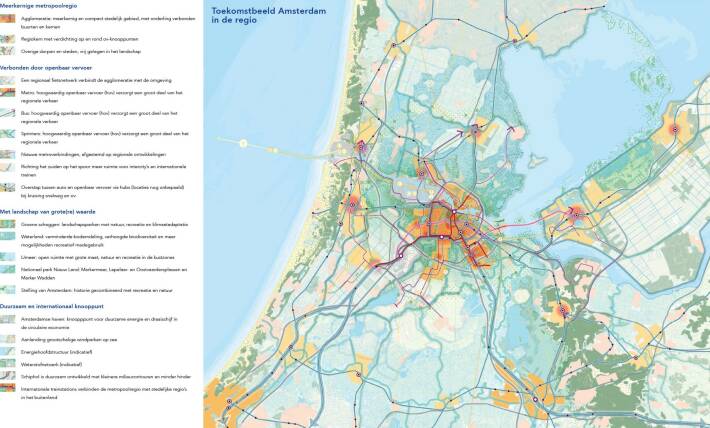
The Amsterdam Metropolitan Region has a strong international position. It is an urban region that accommodates 2.5 million inhabitants, 300,000 businesses and 1.5 million jobs, and extends from Zandvoort to Lelystad, from Heemskerk to Hilversum and from Beemster to Haarlemmermeer. Together with the metropolitan regions of Rotterdam-The Hague, Utrecht and Eindhoven, we attract international knowledge, labour and investment. By means of its own development, Amsterdam aims to help strengthen the entire region as a multicore, cohesive and balanced system. In doing so, the city wants to achieve as much compact growth as possible within its borders. The other strategic choices also include a clear regional component: the commitment to sustainable and healthy exercise requires a significant regional step forward in public transport and good bicycle connections. The greening of the city will be partly reflected in the regional landscape, and we are collaborating with other parts of the metropolitan region to achieve this.

Conurbation
At the conurbation level, we have made a significant leap in our thinking compared to the 2011 Structural Vision. The main spatial focus of the Structural Vision was the city centre rollout. This compact urbanisation strategy focused mainly on the zone immediately surrounding the pre-war city, namely the Ring zone along the A10 and the ring railroad and the central parts of the northern banks of the IJ. The approach
taken was based on Amsterdam as a monocentric city. Recent years have seen the city’s development increasingly tending towards a multicore system. We are supporting and reinforcing this development with the comprehensive vision. The result is an image of the future based on the city’s relationship with the broader region on the one hand, and the city itself consisting of largely self-contained areas on the other.
Urbanisation concept
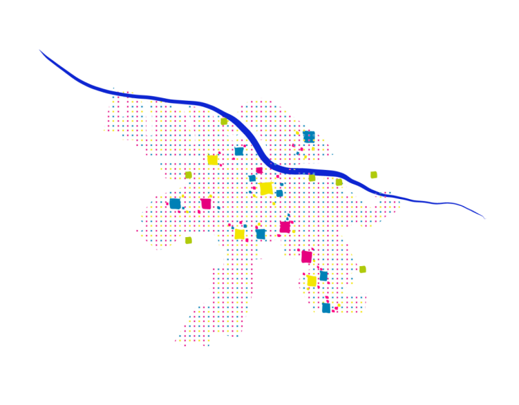
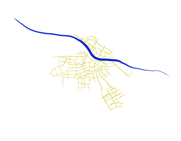
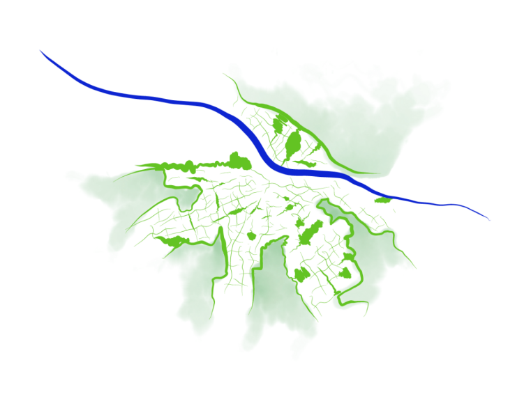
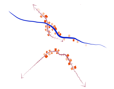
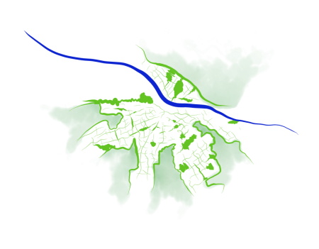
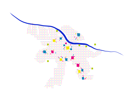
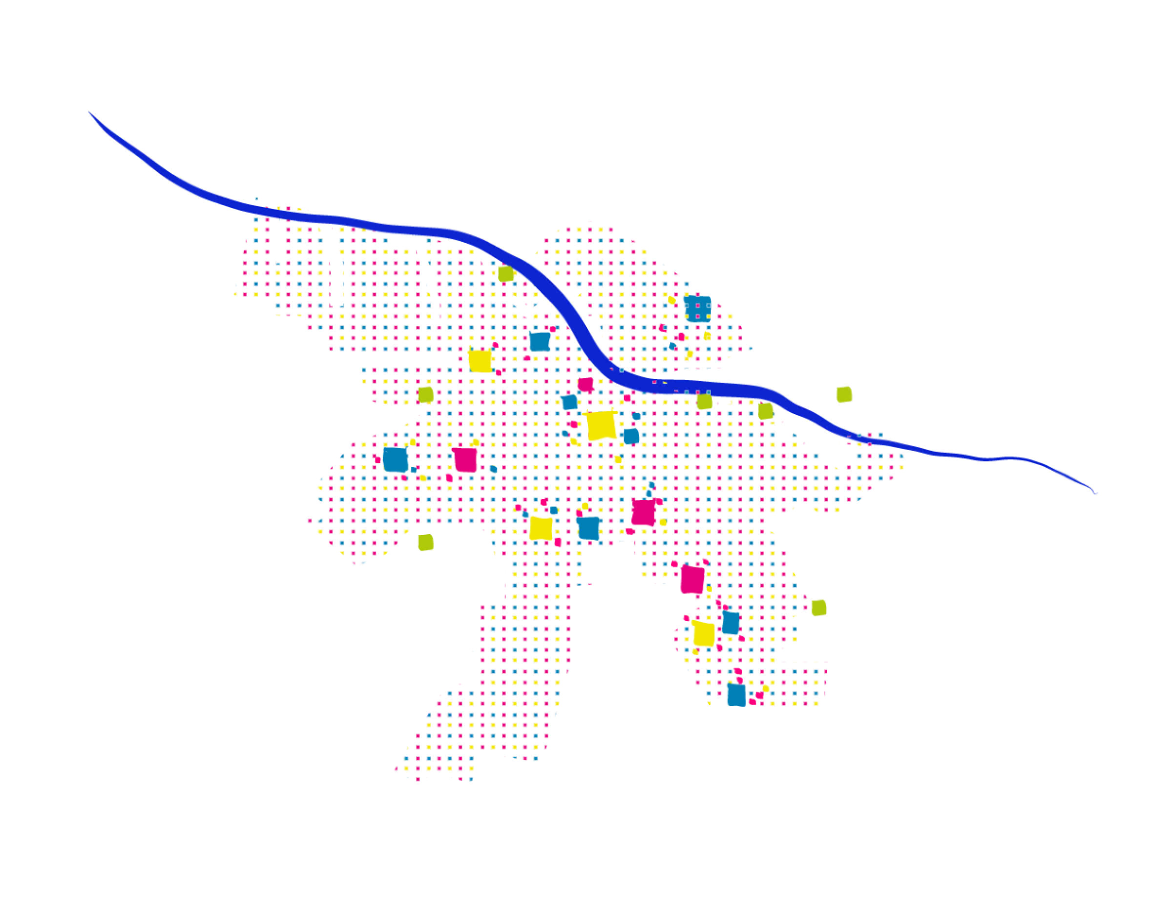
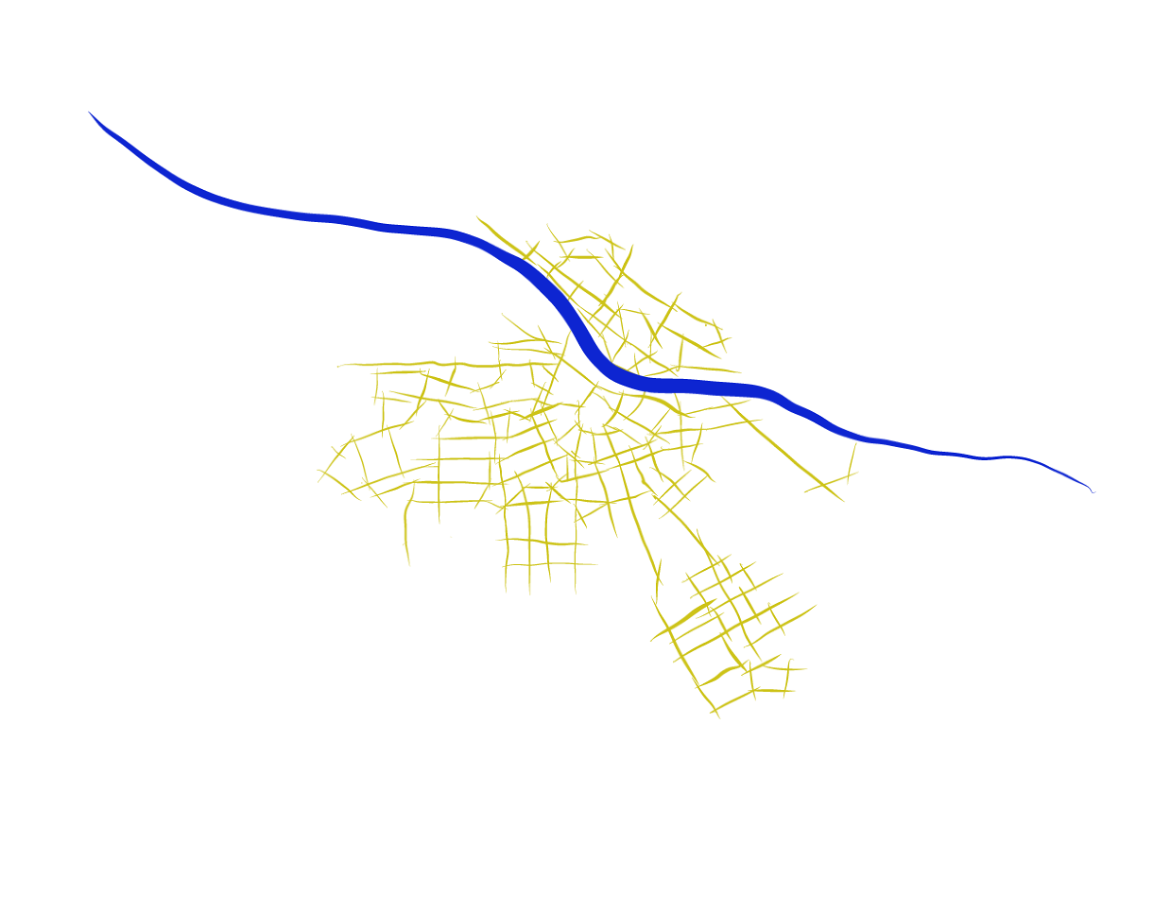
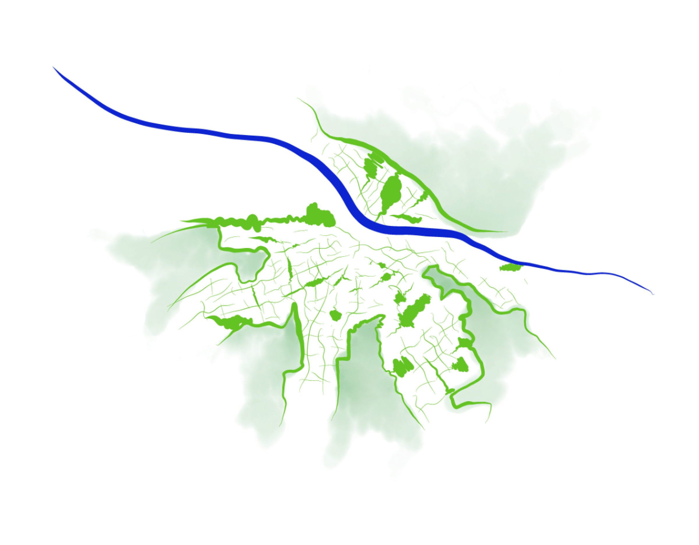
The urbanisation concept for the conurbation features greenery as a foundation, densification of living and working in areas that are easily accessible by public transport, urban locations throughout the city and effective connection by a continuous network of public space.
Densification of living
Greenery as a foundation
Accessibility with public transport
Urban places, well connected

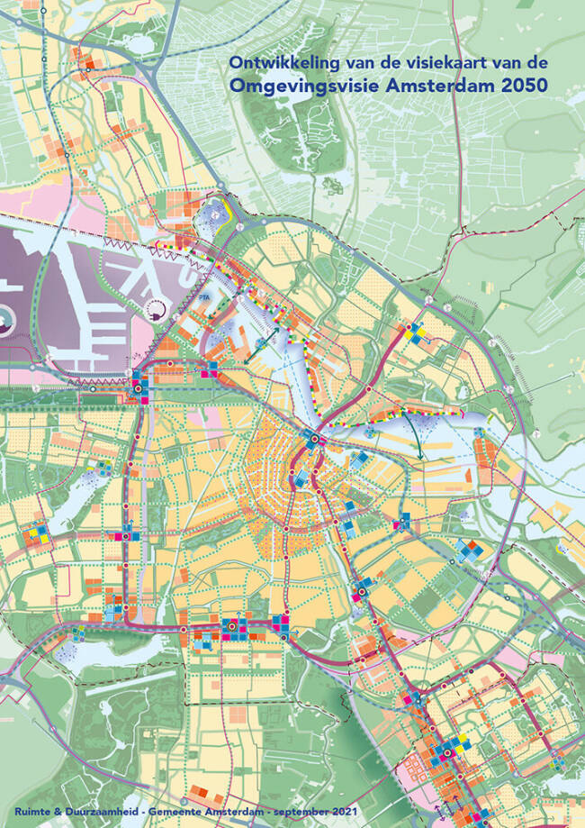
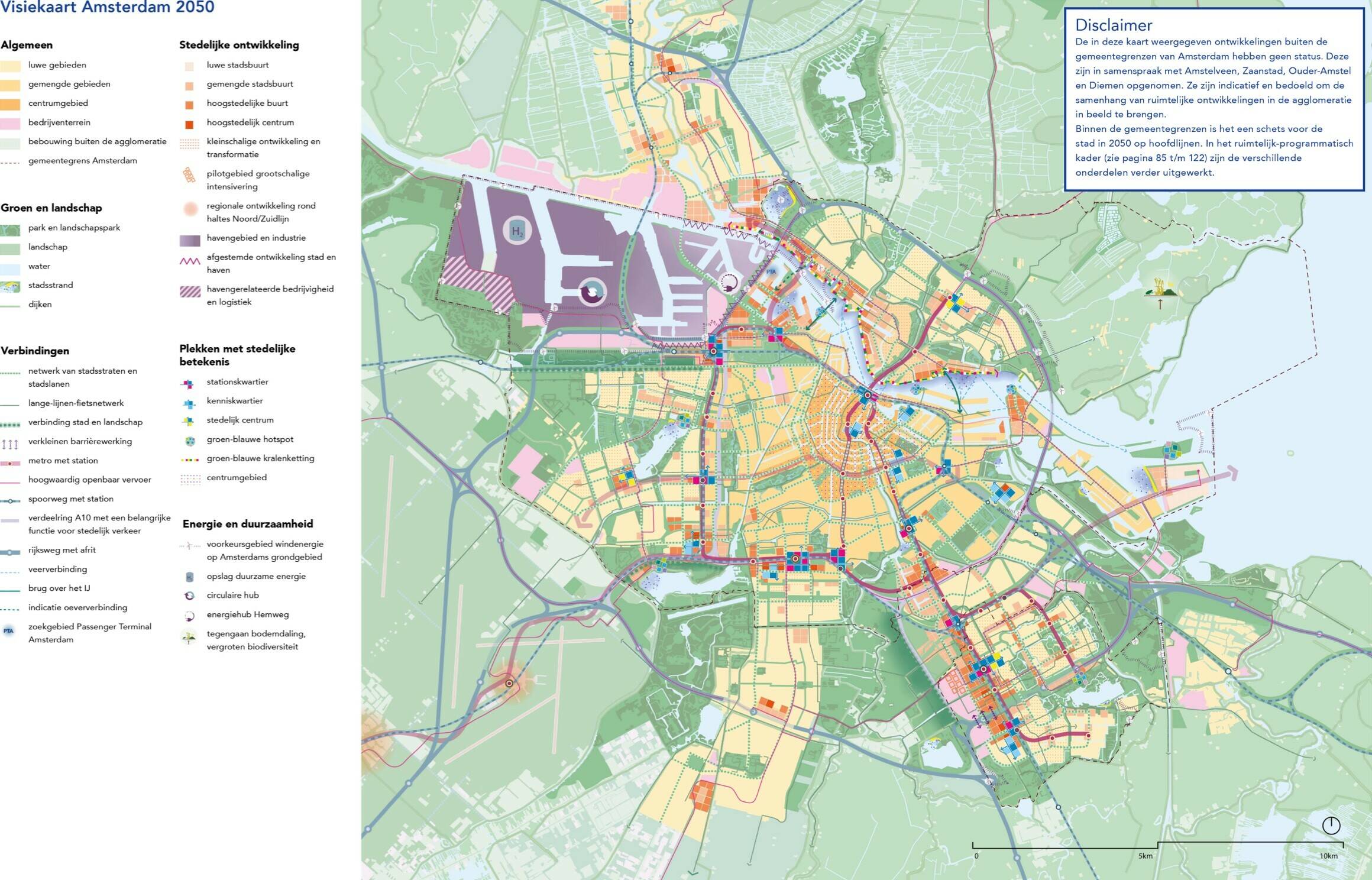
The urbanisation concept for our municipality is detailed in the Amsterdam 2050 vision map and a spatial-programmatic framework. This provides guidance with respect to the city's green spaces, mobility, important public space lines, space for the economy and housing, metropolitan facilities and energy production. For some of these topics, the spatial-programmatic framework provides future goals that we can work toward in steps. For others, it provides guidance for projects and policies in order to ensure consistency in the city's development. By being clear about the main choices available to us, we can make room within them for collaborative citymaking.
Atlas of the Environmental Vision
This is where you can find the vision map, the maps from the spatial-programmatic framework (subdivided into the categories 'public space', 'traffic networks' and 'urban programmes’), as well as all the district maps, with the legends and stories that accompany them. The elements of the legend for the vision map and the district maps appear when you hover your mouse over the map. You can click on them to read a more detailed description. The maps provide guidance for the development of the city. They also provide space for specific interpretations that suit the character of the various areas and locations.
Street level
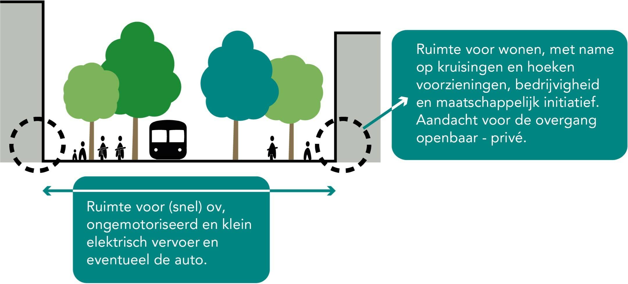
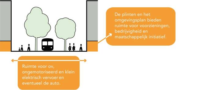
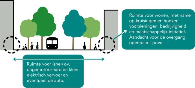
The various themes from the spatial-programmatic framework are not just detailed by means of abstract lines or areas on a map. There is always a link made with the living environment level, and we have drawn up principles to be applied for that level too. For example, a distinction is made between the city streets (principles: residential quality, primarily space for slow traffic, public transport and small electric vehicles, facilities) and the city avenues (principles: residential quality, primarily space for slow traffic, public transport and small electric vehicles, ample space for green and urban living).
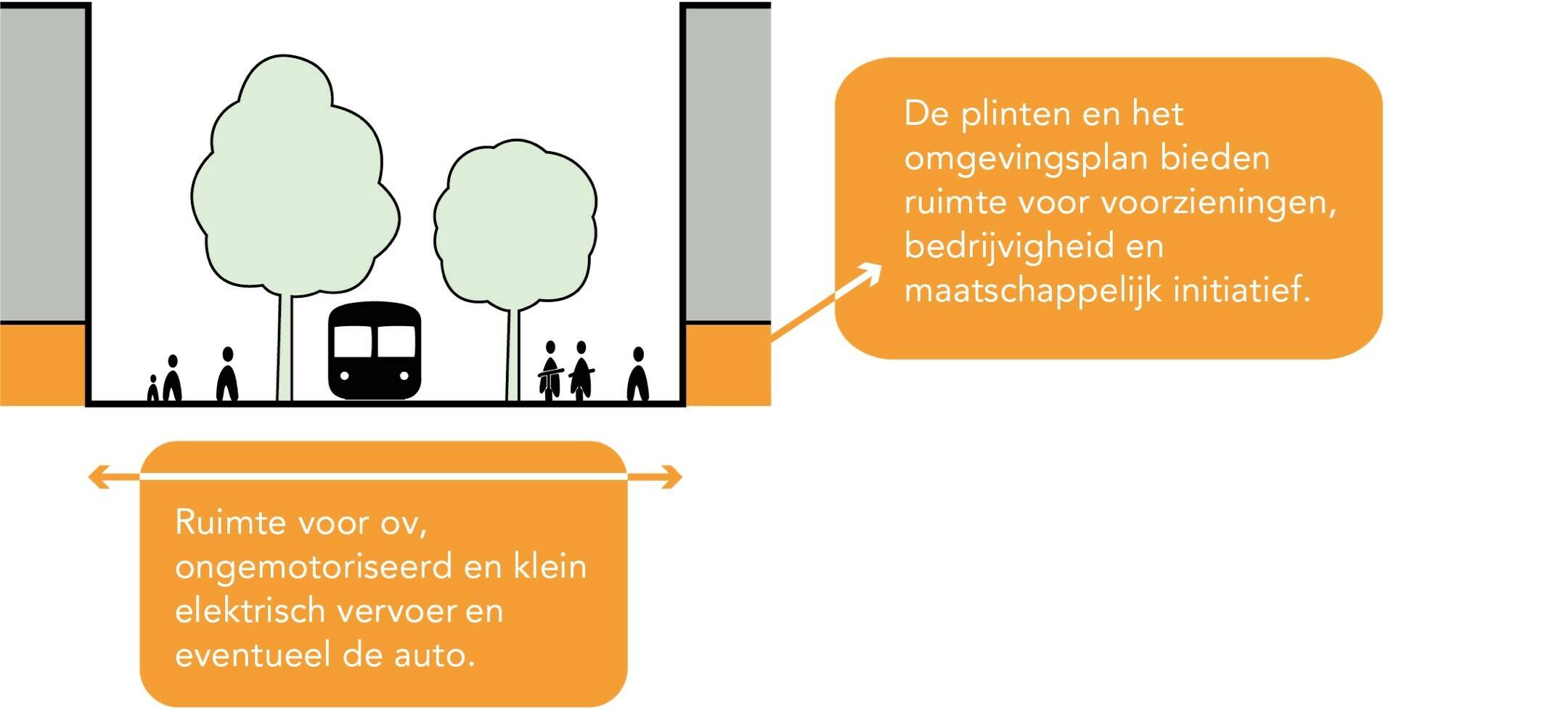
Conceptual drawings of city avenues
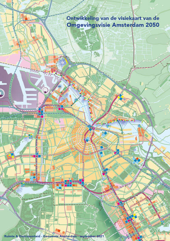
The Amsterdam 2050 vision map
The Amsterdam 2050 vision map came about as a result of many small steps and excursions. You can download a booklet about the development of the map here. It lists the different versions that have come about over time, giving a description of the content and graphic choices for each step.
The five strategic choices in greater detail
By Flora Nycolaas f.nycolaas@amsterdam.nl
We have developed the five strategic choices for each of the different levels, including the region, the conurbation, the city districts and the living environment at street level.
Regional
The Amsterdam Metropolitan Region has a strong international position. It is an urban region that accommodates 2.5 million inhabitants, 300,000 businesses and 1.5 million jobs, and extends from Zandvoort to Lelystad, from Heemskerk to Hilversum and from Beemster to Haarlemmermeer. Together with the metropolitan regions of Rotterdam-The Hague, Utrecht and Eindhoven, we attract international knowledge, labour and investment. By means of its own development, Amsterdam aims to help strengthen the entire region as a multicore, cohesive and balanced system. In doing so, the city wants to achieve as much compact growth as possible within its borders. The other strategic choices also include a clear regional component: the commitment to sustainable and healthy exercise requires a significant regional step forward in public transport and good bicycle connections. The greening of the city will be partly reflected in the regional landscape, and we are collaborating with other parts of the metropolitan region to achieve this.
Conurbation
At the conurbation level, we have made a significant leap in our thinking compared to the 2011 Structural Vision. The main spatial focus of the Structural Vision was the city centre rollout. This compact urbanisation strategy focused mainly on the zone immediately surrounding the pre-war city, namely the Ring zone along the A10 and the ring railroad and the central parts of the northern banks of the IJ. The approach taken was based on Amsterdam as a monocentric city. Recent years have seen the city’s development increasingly tending towards a multicore system. We are supporting and reinforcing this development with the local vision. The result is an image of the future based on the city’s relationship with the broader region on the one hand, and the city itself consisting of largely self-contained areas on the other.
Urbanisation concept
Densification of the city in places that are easily accessible by public transport and connected to the region. On the southern side of the city, this is along the railway and metro towards Zuidoost and Schiphol, and on the northern side along the railway, HOV (high-quality public transport) and metro towards Zaandam. The major development areas are closely linked with existing neighbourhoods by means of thoroughfares and greenways. There is also space alongside these for densification and new urban quality in existing neighbourhoods. This densification, together with the strengthening of urban locations throughout the city, constitutes multicore development based on the area’s unique character and qualities. These cores and neighbourhoods are connected to each other and to the centre by a continuous and natural network of attractive and green streets. Sufficient green space locally and in public spaces, and good connections to the landscape and water create a liveable and climate-resilient city.
The urbanisation concept for the conurbation features greenery as a foundation, densification of living and working in areas that are easily accessible by public transport, urban locations throughout the city and effective connection by a continuous network of public space.
Densification of living
Greenery as a foundation
Accessibility with public transport
Urban places, well connected
The urbanisation concept for our municipality is detailed in the Amsterdam 2050 vision map and a spatial-programmatic framework. This provides guidance with respect to the city's green spaces, mobility, important public space lines, space for the economy and housing, metropolitan facilities and energy production. For some of these topics, the spatial-programmatic framework provides future goals that we can work toward in steps. For others, it provides guidance for projects and policies in order to ensure consistency in the city's development. By being clear about the main choices available to us, we can make room within them for collaborative citymaking.

Atlas of the Environmental Vision
This is where you can find the vision map, the maps from the spatial-programmatic framework (subdivided into the categories 'public space', 'traffic networks' and 'urban programmes’), as well as all the district maps, with the legends and stories that accompany them. The elements of the legend for the vision map and the district maps appear when you hover your mouse over the map. You can click on them to read a more detailed description. The maps provide guidance for the development of the city. They also provide space for specific interpretations that suit the character of the various areas and locations.
de Omgevingsvisie (extern)
Street level
The various themes from the spatial-programmatic framework are not just detailed by means of abstract lines or areas on a map. There is always a link made with the living environment level, and we have drawn up principles to be applied for that level too. For example, a distinction is made between the city streets (principles: residential quality, primarily space for slow traffic, public transport and small electric vehicles, facilities) and the city avenues (principles: residential quality, primarily space for slow traffic, public transport and small electric vehicles, ample space for green and urban living).
Conceptual drawings of city avenues
The Amsterdam 2050 vision map
The Amsterdam 2050 vision map came about as a result of many small steps and excursions. You can download a booklet about the development of the map here. It lists the different versions that have come about over time, giving a description of the content and graphic choices for each step.